
Cemeteries
Where to find them
Sorted by name or cemetery code.
Clicking on the GPS coordinates will open up a map in a new browser tab.
Cemeteries in grey are listed under another name.
Cemeteries in blue are unconfirmed - either they are a "best guess" or we haven't visited them to confirm GPS location.
Cemeteries in red were either destroyed or moved.
 |
 Previous Previous
|
2 3 4 5 [Page 6 of 8] 7 8 |
Next 
|
 |
| Name | Code | Description | 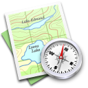 GPS |
| OLD HOG MT. | OHM | See Old Hog Mt. Baptist | |
| OLD HOG MT. BAPTIST (Org. 1854) | OHM | NW side SR 124 & Hog Mt. Church Road across from church. | 34.051326, -83.926500 |
| OLD LAWRENCEVILLE | LTC | See Lawrenceville Town | |
| OLD LEVEL CREEK METHODIST (Org. 1822) | OLC | Off Suwanee Dam Rd., mi. N. of Level Creek Rd. | 34.098876, -84.081690 |
| OLD MIDWAY METHODIST | RKS | See Rakestraw | |
| OLD MT. ZION BAPT. (Org. 1849) | OMZ | 300 yds. SE of MZB, in woods. [5-073-002] | |
| OLD NEW HOPE | PRT | See Pruett | |
| OLD PEACHTREE PRESBYTERIAN | See Bethel Presbyterian (BEP) | ||
| OLD ROCK BRIDGE BAPT. | ORK | SW side Egypt Road off SR 124. Granite and fieldstones. One grave moved to ROC. [6-004] | |
| OLD SUWANEE | SUW | See Suwanee | |
| OLD ZION HILL BAPT. (Org. 1868) | OZH | aka Raimey. Junction Puckett & Ridge Rds, near Hamilton Mill | 34.098649, -83.933684 |
| OLD ZOAR METH. | OZM | W of SR 124, NE of Everson Rd. [6-035-007] | |
| OLIVER (?) | OLI | E of SR 124 on dirt road off Egypt Road, .25 mi. up hill, on rt. [6-004] | |
| OMER CHRISTIAN (Org. 1882) | OMR | SR 324, .25 mi. off SR 81, Winder, Barrow Co | |
| OZORA BAPTIST (Est. 1912) | OZO | Ozora Road, SW of Chandler Road NW corner Burton Rd. [5-197-005] | 33.893891, -83.901164 |
| PARSONS-STRICKLAND | PAR | aka Henry Strickland. Behind 3229 Parsons Ridge, Lwvl. [7-199-003] | |
| PAUPER I (1850-1893) | PAU | Old Norcross Road, NE cor. McElvaney Dr. [7-036] | |
| PAUPER II (1893-1907) | PPR | W side Old Snellville Hwy., N of Rocky Rd. [5-075-012] | |
| PAUPER III (1908-c.1936) | POR | End of Wilson St., edge of Gwinnett Justice & Admin. land. [5-142-144] | |
| PEACHTREE ROAD BAPT. | OFB | See Old Field Baptist | |
| PEAVY | PEA | Macks Rd., off Indian Shoals & Berry Hall Rds. In woods behind houses off of Haddington Trace; one headstone, numerous fieldstones | 33.924564,-83.819114 |
| PEEVY | PEE | aka Maffett. Jct. Rock Springs Road & Old Peachtree, W of SR 20, S of I-85 [7-149-002] | |
| PETTY | PTY | S side Hillside between SR 20 & SR 124, Grayson [5-120] | |
| PHARR | HIG | See Higgins-Towler | |
| PHARR-HAMILTON | FRR | See Farr-Hamilton | |
| PICKENS-LEE | PKL | Moved in 1988 from Park Place St. Mtn. to Melwood Cem., Tucker [6-060] | |
| PINEY GROVE BAPTIST | PIN | Flowery Branch | |
| PIONEERS | LTC | See Lawrenceville Town | |
| PIRKLE | TVG | See Tuggle | |
| PITTMAN | PTM | nr. Chattahoochee River, Pinkneyville. Possibly Waits(WAI) | |
| PLEASANT GROVE BAPTIST (Org. 1908) | PGB | New Hope Road at Bowman Road. | 33.929413, -83.934311 |
| PLEASANT GROVE METH. | PGM | E. side Glenn Club Dr., N. of US 78, Stone Mountain | 33.825690, -84.109556 |
| PLEASANT HILL BAPT | PHD | Chamblee-Tucker Rd. at Norcross-Tucker Rd. (Pittsburg) | 33.881664, -84.221604 |
| PLEASANT HILL BAPT. (Org. 1893 as Zion Bapt.) | PHB | 1782 Pleasant Hill Rd., Duluth. Name changed 1949 to PHB [6-204-009] | |
| PLEASANT HILL METH/COMMUNITY | PLH | NE of SR 316 on Fence Rd. Meth. Ch. est. 1837, moved in 1857 2 mi. East. Continues to be community cem. 1955 church renamed Hinton Memorial. | 33.986154, -83.925606 |
| PLEASANT HILL MISSIONARY BAPT. (Org. 1939) | PHM | Hamilton Mill Rd., SW of I-85, Buford | 34.102911, -83.970887 |
| PLUMMER | HAW | See Hawthorn | |
| POUNDS | POU | S of US 29, off Jimmy Carter, in Royal Atlanta Bus. Pk. Fenced in area at top of hill. | 33.859488, -84.174065 |
| PROSPECT METH. (Org. 1830) | PMC | 3 mi. NE of Lawrenceville, E of SR 124 | 34.019539, -83.959492 |
| PROSPERITY (Doraville) | PRO | aka Doraville Presb., betw. Chamblee & Doraville | 33.897217, -84.291530 |
| PRUETT | PRT | aka Old New Hope Meth., off Lwvl-New Hope Rd. & Callie Still Road. Turn E before bridge over creek. [5-231-091]. Archer High School campus at 2255 New Hope Rd. | 33.916236, -83.890846 |
| PUGH | PGH | Moved to various places in 1956 to prepare for Lake Lanier flooding. | |
| PULLIAM | PUL | On Tanner farm, Appalachee Road. near Bettstown. Fence across road to cem. | |
| PURCELL | GRN | See Garner-Purcell | |
| QUINN | BRO | See Brewer-Quinn of Duluth | |
| RAINEY | RNY | SR 11, left on City Pond Rd., left on Harton, Winder. | |
| RAKESTRAW | RKS | aka Old Corinth/Midway Meth., Ethridge, Kilcrease. Corner Kilcrease & Fred Kilcrease Rds. In woods off of Duncan Lane; one headstone, numerous fieldstones and box graves | 33.967086, -83.823276 |
| RAMEY | OZH | See Old Zion Hill | |
| RAWLINS | CNT | See Corinth Baptist, St. Mtn. | |
| RAWLINS, PETER | RLP | 2286 Street Deville. SE corner of Street Deville & Eldorado Place, Snellville | 33.849605, -84.004258 |
| RAWLINS-BORING | RAW | 1.5 mi. S of US 78 at Rosebud & Brushy Fork Roads. [5-128-027] | |
| RAWLINS-CLACK | RLS | 2.4 mi. SE of SR 124 on Lenora Church Road. Cem. in woods. [5-004-001] | |
| RAYMOND HILL BAPT. (black)(Org. 1875) | RHB | S side of US 78 on Rosebud Road, E of Summit Chase C.C. [5-092-002] | |
| RED LAND BAPT. (Est. 1823) (Dissolved 1849) | RLB | Behind 324 Regal Dr., Lwvl [R5-114-184] | |
| REEVES | HLL | See Hall | |
| REID | BCK | See Brock | |
| RICHARDSON | RCD | N side Alcovy-Dacula Road, original site of Hebron Bapt. [5-268-018] | |
| Richardson-Harris | RHC | In Gwinnett Progress Center US29 & 316. This might be HRR [5-242] | |
| RICHEY | RCH | Across from 85 Huff Dr., by RR, Gloster [5-018-012] | |
| RIVERSIDE BAPT. (Org. 1921) | RIV | E & W side Suwanee Dam Road, N of Riverside Rd., Sugar Hill | 34.123120, -84.074767 |
| ROBERTS | RBT | In Ed Roberts' father's yard, Grayson, later moved to SNL | |
| ROCK SPRINGS METHODIST (Org. 1866) | RSM | N side Rock Springs Rd., W of SR 20, S of I-85. 1100 Rock Springs Rd | 34.047548, -83.997355 |
| ROCKBRIDGE BAPT. (Moved here 1893) | ROC | E side SR 124, S of Annistown Road. | 33.800257, -84.042688 |
| ROCKBRIDGE BAPT. (Old) | ORK | See Old Rockbridge Bapt. | |
| ROCKY BRANCH BAPT. (Org. 1911) | RBB | N. side Five Forks Rd., W. of Patterson Rd. | 33.912015, -84.030491 |
| ROGERS (black) (Indians) (Fulton Co.) | RGS | NW side Bell/Boles Rd., off McGinnis Ferry Rd. (possibly CORDURY-ROGERS(CRD)) | |
| ROGERS-BELL (Fulton Co.) | ROB | SE side Rogers Cir., off Bell Rd. | 34.041302, -84.130463 |
| ROLLINS, Pete | ROL | SE cor. Deville & Eldorado Pl, Snlvl. [5-037-023] | |
| ROWDEN-FINDLEY | RWF | NW cor. Bryant St. & Killian Hill [6-111-108] | |
| RUTLEDGE | WPW | Centerville, See Williams Pittman Williams | |
| RUTLEDGE-PLUMMER | HAW | See Hawthorn | |
| SALEM BAPT. (black) | SAL | Church Street off Killian Hill Rd., Lilburn [6-147-052] | |
| SAMMON-DUNLAP-WOOD-McELROY | SAM | On Hurricane Shoals Rd. N & W of Rabbit Hill [7-017-021] | |
| SARDIS METH. (Est. 1810) | SMC | Thompson Mill Rd., E. of Sardis Ch. Rd., at Hall Co. line. Church originally in Jackson Co. | 34.100437, -83.878261 |
| SAWYER | HOM | See Holmes |
|
Previous
|
2 3 4 5 [Page 6 of 8] 7 8 |
Next
|
|